# Geolocation
The geolocation is based on the IP address found in the host field from the log files. The Geoip header allows to choose which data is to be added to the results, or to deactivate the geolocation altogether.
The library used for this is geoip-lite (opens new window).
Geolocation Caveats : IP address geolocation is a method that links the IP address of a terminal connected to the internet with a geographical position. The level of precision is not always the same: city in the best of cases, country otherwise.
The geolocation data is informative (opens new window) and depends on the country as well as the internet access provider.
# Parameters (headers)
Geoip: geolocation data that can be added to the results.
By default: geoip-longitude, geoip-latitude, geoip-country
allcan be used to include all possible fieldsnoneto deactivate the geolocation.
The available fields are:
geoip-host: IP address being geolocalizedgeoip-country2 characters code indicating the country (eg:FRforFrance)geoip-region: 2 characters code indicating the region (eg:A8forÎle-de-France)geoip-city: complete name of the city (eg:Paris)geoip-latitude: self-explanatorygeoip-longitude: self-explanatorygeoip-coordinates: concatenation of latitude and longitude between brackets (eg:[48.8592,2.3417])
Usage example:
curl -v -X POST --proxy "" --no-buffer \
  -F "file=@test/dataset/geolocalize.log" \
  -H 'Geoip: all' \
 	http://127.0.0.1:59599
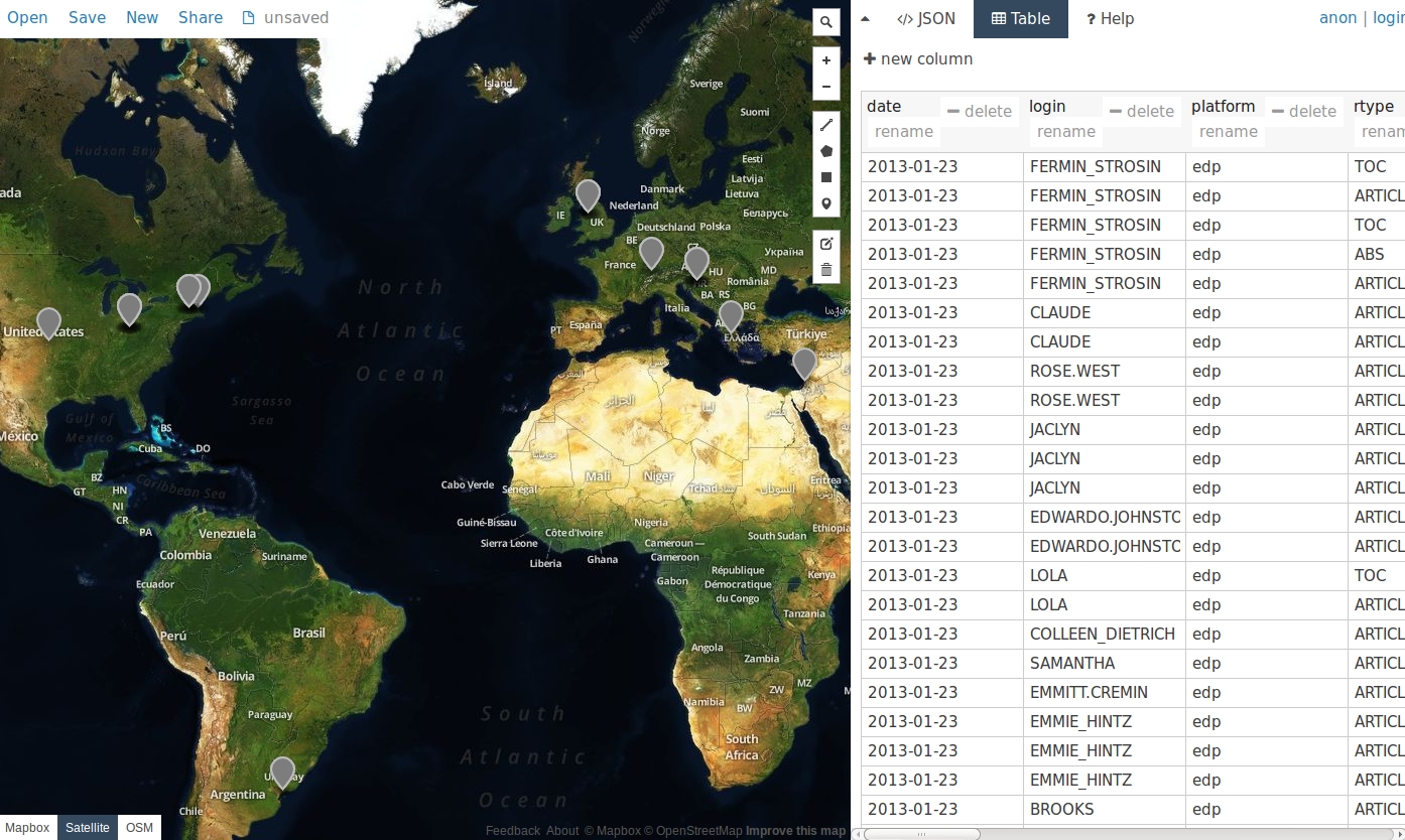
Advanced usage example:
This example uses the ''csv2geojson'' and ''geojsonio-cli'' librairies.
npm install csv2geojson geojsonio-cli
It is then possible to directly visualize the results on a map.
curl -X POST http://127.0.0.1:59599 \
  --proxy "" \
  --no-buffer \
  --data-binary @./test/dataset/edp.2013-01-23.log  \
  -H 'Geoip: geoip-latitude, geoip-longitude' \
  -H 'Output-Fields: -doi,-identd,-url,-status,-size,+datetime' \
  | csv2geojson --lat "geoip-latitude" --lon "geoip-longitude" --delimiter ";" 2> /dev/null \
  | geojsonio
That opens a web browser with the following graphical representation :
# Video Demonstration
This screencast (opens new window) demonstrates the previous usage (ie geolocation information visualized on a map)